
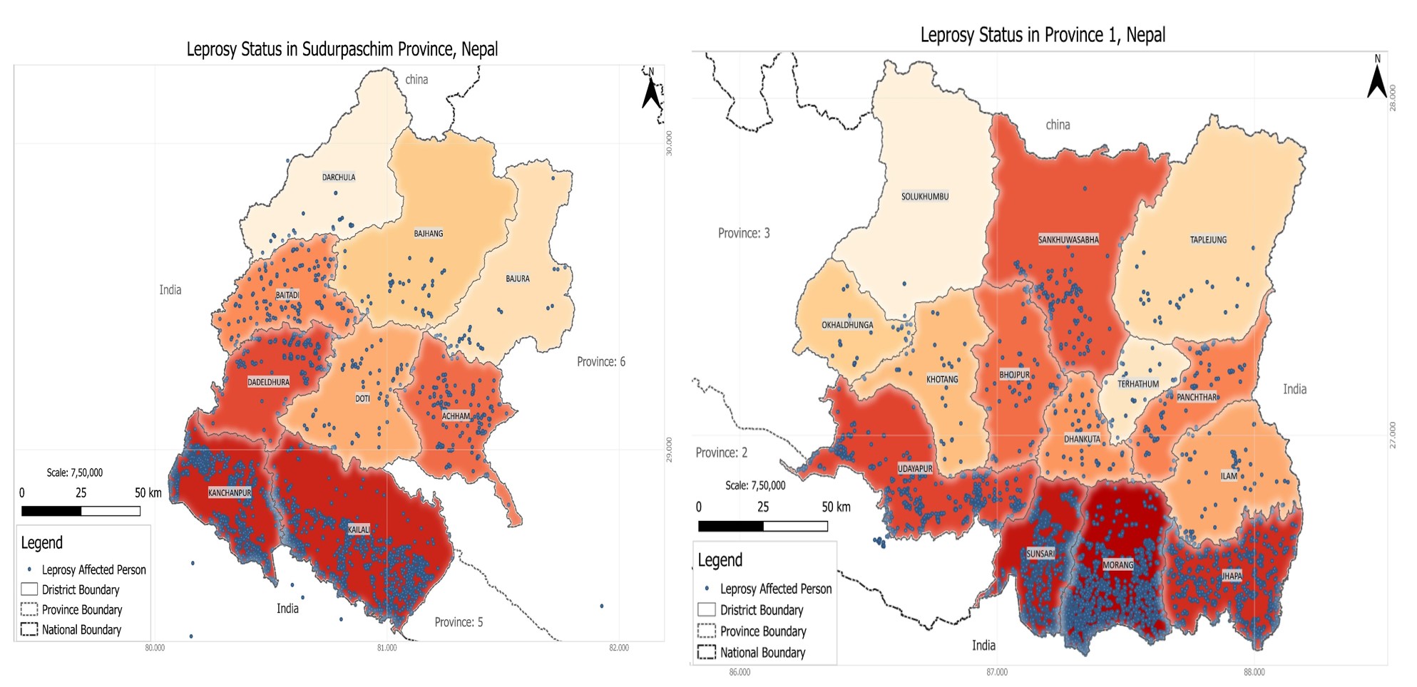
 Use of epidemiological and GIS methods to identify geographic clusters of leprosy cases in both urban and rural settings for the application of rapid screening and/or intensified case finding protocols.
The main study deliverable will be a workflow and best practice guide for MoHs and leprosy organizations for the usage of geospatial data analysis methods to identify clusters of leprosy patients to better implement and roll out PEP interventions. The best practice guide will document each step and variable choices that have been made in this study.
This Project run in Province 1 and 7 of all Districts and Local levels.